If you love to sail, three little words can make or break your home search in Punta Gorda: “sailboat access homes.” You want a dock where your boat can reach open water without surprises. But listings use the term loosely, which can lead to costly mistakes. In this guide, you’ll learn exactly what sailboat access means here, how to verify it for your boat, and the questions to ask before you write an offer. Let’s dive in.
What “sailboat access” means in Punta Gorda
When a listing says sailboat access, it usually means you can navigate from the property’s dock to Charlotte Harbor and the Gulf of Mexico without hitting a fixed vertical or depth limit that stops your mast or keel. In Punta Gorda, that comes down to two things: enough water depth for your draft and no low fixed bridges on your route.
Because Punta Gorda has a mix of canal communities, including Punta Gorda Isles, as well as harborfront properties, conditions vary from street to street. One canal might suit a shallow-keel cruiser, while another may work for a taller-masted or deeper-draft yacht. Always verify for your specific vessel before you buy.
Key factors to verify for your boat
Vertical clearance (air draft)
Check every bridge between the dock and open water. Drawbridges open on schedules, while fixed bridges have a set clearance that can block taller masts. Confirm clearances with the U.S. Coast Guard bridge information and cross-check with NOAA nautical charts for Charlotte Harbor.
Water depth (controlling depth)
You need enough depth under your keel at the lowest tides along the entire route. As a practical guide, shoal-keel cruisers often need about 3–5 feet, many coastal cruisers need 5–8 feet or more, and deeper-keel boats may need 8 feet or more. Charts and listings may say “deep water,” but you should get numbers at mean low water. Review depths on NOAA charts and check local tide predictions on NOAA Tides & Currents.
Canal width and turning room
Narrow canals can make docking or turning difficult for longer boats or wider beams. Make sure you have enough room to maneuver into the slip and turn toward the main channel.
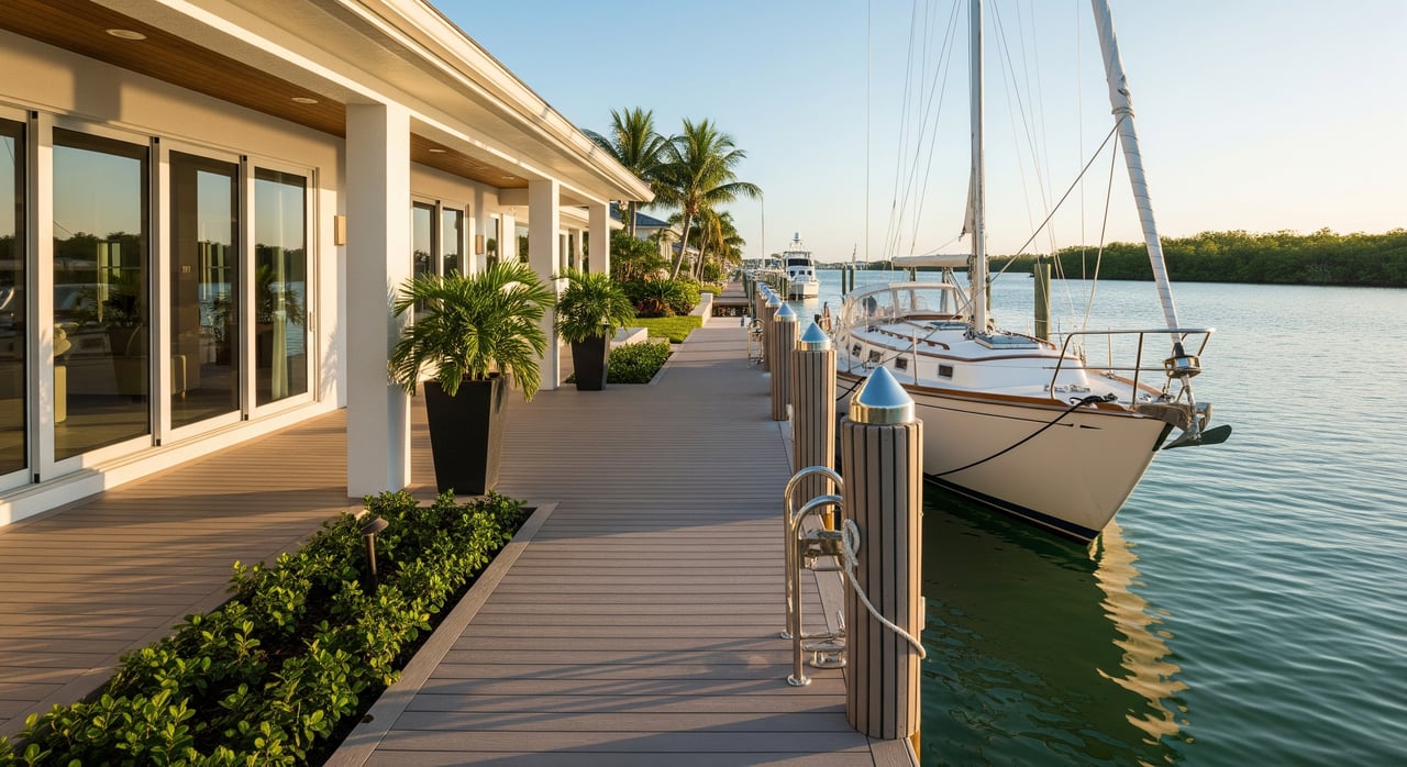
Seawall, dock, and lift capacity
Confirm the dock length, piling spacing, and any lift’s weight and beam limits. Seawall condition affects safety and future permitting. Ask for maintenance records when available.
Tides and currents
Charlotte Harbor’s tidal range is modest, but low tide still matters for minimum depths. Check the timing and height of lows with NOAA tide predictions. Inlets and the harbor mouth can have currents that affect maneuvering.
How to confirm access for a specific property
Start with charts and maps
- Review the route on NOAA nautical charts to identify controlling depths, channels, and bridge notes.
- Check tide patterns on NOAA Tides & Currents so you know the real low-water picture.
- Use county and city resources to understand parcel location, canal layout, and permitting layers. Start with Charlotte County’s website and the City of Punta Gorda planning pages.
- Look up flood zones and base flood elevation on the FEMA Flood Map Service Center.
Check local records and permits
- Verify dock, lift, and seawall permits with Charlotte County or the City of Punta Gorda. These records confirm what exists and what you can replace.
- Review shoreline and submerged lands rules through the Florida Department of Environmental Protection.
- Confirm bridge types and clearances along your route using U.S. Coast Guard bridge listings.
Validate on site before closing
- Request a recent depth survey at mean low water or commission a professional sounding to confirm the controlling depth from the dock to the harbor.
- Hire a local captain or marine surveyor to run the route at low tide and evaluate turning room, shoaling, and bridge clearances.
- Inspect the dock, lift, and seawall and request maintenance records.
Spot red flags early
- “Sailboat access” without numbers for depth or bridge clearance.
- No permit records or unknown seawall age.
- Charted shoaling or local advisories about changing channel depths.
- HOA rules that limit boat length, beam, dock changes, or transient guests.
Reading listing language like a pro
- “Sailboat access” is a starting point. Ask for specific depth numbers at mean low water and bridge clearances.
- “No fixed bridges” often favors taller masts, but confirm the route using Coast Guard data and NOAA charts.
- “Deep water” or “deep-water lot” needs a number. Ask, “How many feet at MLW at the dock and along the route?”
- “Direct Gulf” or “direct harbor access” suggests fewer obstructions. Still verify controlling depth for your draft.
- “Private dock” or “dock included” means you should confirm permitting, length, condition, and lift specs.
- “Seawall in good condition” should be backed by an inspection report or permit history.
Buyer checklist to get answered in writing
- What is the controlling depth at mean low water from the dock to open water? Provide a recent sounding or chart reference.
- Are there any fixed bridges on the route? If yes, what are the clearances at mean high and low water? Provide a source.
- Is the dock permitted? Share permit numbers and approval documents.
- What are the dock dimensions, piling spacing, and lift capacity? Include manufacturer specs and maintenance records.
- Do HOA or deed restrictions set limits on boat length, beam, or guest docking?
- What flood zone and Base Flood Elevation apply? Provide the FEMA map panel.
- Are there recent notices about shoaling, dredging, or channel changes that affect the route?
- Has a local captain or surveyor run the route at low tide recently? If not, plan one before closing.
Local rules, insurance, and HOAs to consider
New docks, lifts, and seawalls typically need permits through Charlotte County or the City of Punta Gorda, and sometimes the state. Environmental protections for mangroves or seagrass can affect what you can build. Review shoreline guidance from the Florida Department of Environmental Protection.
Most waterfront homes sit in mapped flood zones. Your lender and insurer will consider the property’s flood zone and elevation. You can check these designations at the FEMA Flood Map Service Center. For boating, many insurers want documentation of dock capacity and condition. If your community has an HOA, read the rules that govern boat size, use, and dock modifications before you submit an offer.
For safe operation and local rules on the water, review Florida boating safety and regulations.
Matching boat dimensions with canal realities
Use these rough planning ranges, then confirm for your specific boat:
- Shoal-draft daysailers or trailerable boats with about 2–4 feet of draft often manage shallower canals and inshore docks.
- Many coastal cruising monohulls with about 4–6 feet of draft are most comfortable with 5–8 feet of controlling depth.
- Deep-keel or performance cruisers with 7–10 feet of draft usually need 8 feet or more and generous turning room.
- For air draft, small cruisers may have masts around 30–40 feet, while larger boats can exceed 50–70 feet. Check fixed bridge clearances and allow a safety margin.
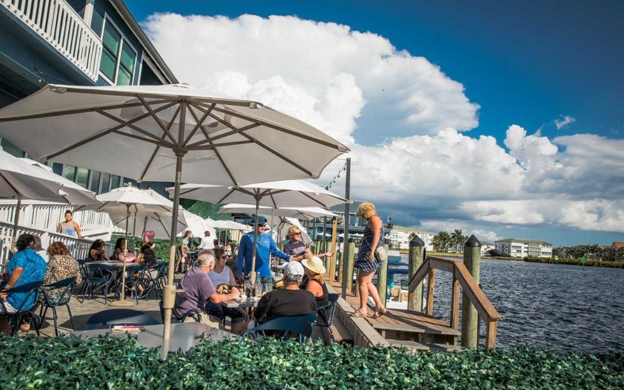
The Punta Gorda advantage for sailors
Punta Gorda gives you a true waterfront lifestyle with quick access to Charlotte Harbor. The tidal range is modest, which helps keep depths close to charted values, but shoaling can change conditions. Listings that say “no fixed bridges” or “direct harbor access” are promising, yet you still want to validate every detail for your boat. A little homework upfront can save time and money later.
Ready to search smarter?
If a waterfront move is on your horizon, you deserve a guide who understands canals, depths, and local rules as well as the housing market. We help you focus on the right streets, confirm the details that matter, and buy with confidence. To talk through your plans or start a tailored search, connect with Jennifer Calenda.
FAQs
What does “sailboat access” mean in Punta Gorda real estate?
- It indicates a practical route from the property’s dock to Charlotte Harbor without fixed bridge or depth limits that block your mast or keel, but you must verify specifics for your boat.
How do I check bridge clearances from a home to Charlotte Harbor?
- Use U.S. Coast Guard bridge information and confirm notes on NOAA nautical charts for every bridge on your route.
What depth counts as “deep water” for midsize cruisers?
- Many coastal cruising monohulls are comfortable when the controlling depth is about 6–8 feet at mean low water, though your boat’s draft should drive the final call.
Do I need a permit to replace a dock or lift in Charlotte County?
- Most dock, lift, and seawall work requires permits through county or city offices and may involve state review; start with Charlotte County’s site and the City of Punta Gorda.
How do flood zones affect buying a waterfront home in Punta Gorda?
- Flood zones and base flood elevation influence insurance and lending; you can look up a property at the FEMA Flood Map Service Center.
Who can verify depths and routes before I buy?
- A marine surveyor or local captain can run soundings and the route at low tide, and you should support that with NOAA tide data and official charts.